


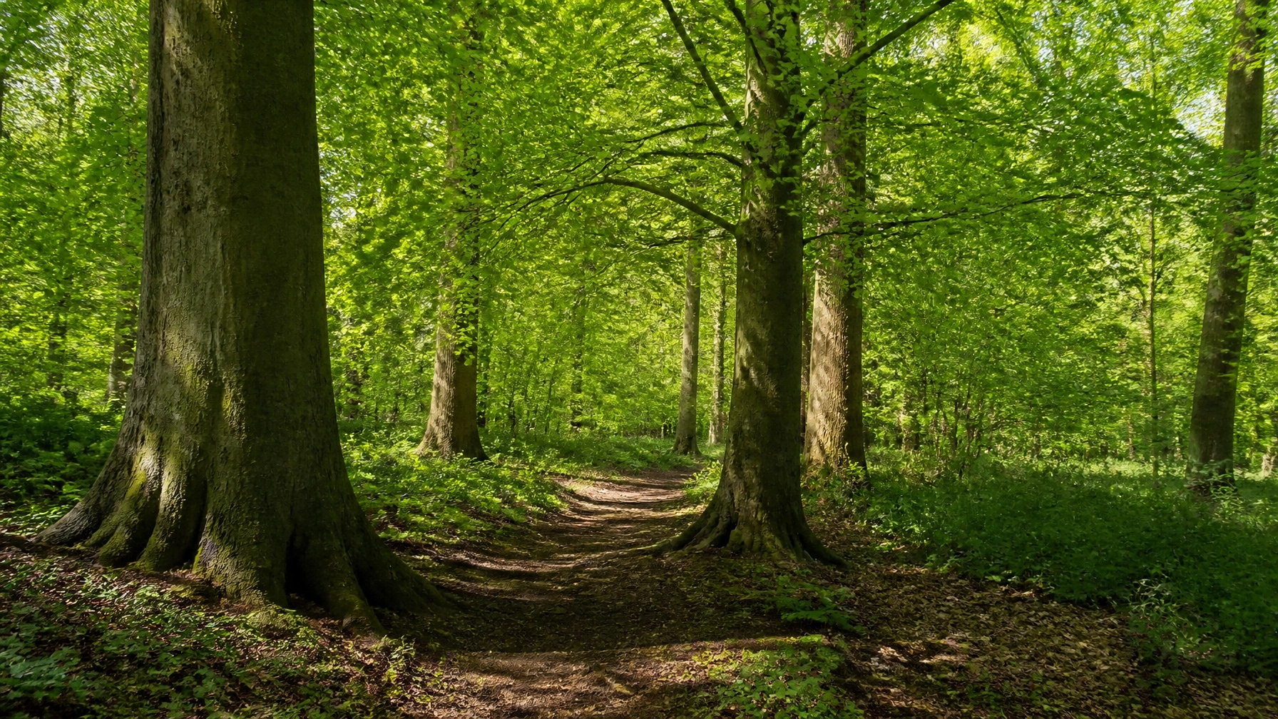
Hertfordshire has long been cherished for its rolling hills and pockets of greenery, but a recent discovery has revealed that the county is far more densely packed with history than anyone previously realised. The Herts and Middlesex Wildlife Trust has announced a stunning update to the region's natural records, revealing that there is actually 50% more ancient woodland across the county than was documented in the original inventory conducted between 1981 and 1992. This surge in recognised woodland represents a monumental shift in how we understand the local landscape, transforming Hertfordshire’s status into one of the more significantly wooded counties in the south of England.
The revelation comes following a comprehensive re-evaluation of the landscape using modern technology and decades of boots-on-the-ground research. For years, the official records suggested a certain limit to these precious habitats, but the new data shows that hundreds of hectares had been overlooked or simply lacked the formal classification required to be protected as "ancient." This isn't just about finding more trees; it is about identifying ecosystems that have remained undisturbed for centuries, providing a unique window into the natural world as it existed long before the industrial revolution or the sprawl of modern infrastructure.
Ancient woodlands are defined as areas that have been continuously wooded since at least 1600. In the context of the UK, these sites are irreplaceable. They are the nation's equivalent of the rainforest, hosting complex underground fungal networks and soil structures that take hundreds of years to establish. The fact that Hertfordshire holds half as much again as previously thought is a major win for conservationists and local residents alike, offering a renewed sense of pride in the county’s environmental heritage.
Rare Flora and Fauna of the Forest Floor
The significance of these newly identified woodlands lies in the life they support. These are not merely collections of trees; they are vibrant, ancient communities of plants and animals that cannot survive in younger, secondary forests. Among the most iconic residents of these woods are the bluebells, which carpet the forest floor in a sea of violet every spring. While bluebells can be found in various settings, their presence in such high density is a hallmark of ancient soil that has not been ploughed or disturbed for centuries.
More elusive species have also been documented thanks to the diligent work of ecologists and volunteers. The herb Paris, a distinctive and rare plant with a single four-leaved whorl, is often cited by botanists as a key indicator of ancient woodland. Its presence in these newly mapped areas confirms their ecological pedigree. Alongside these plants, the woodlands provide a sanctuary for bird species that are increasingly under pressure across the wider British countryside. The marsh tit, a small bird with a glossy black cap, relies on the complex structure of old-growth forests for nesting and foraging. Its decline elsewhere makes the preservation of these Hertfordshire sites even more critical.
High above the forest floor, the ancient canopies serve as vital hunting grounds for rare mammals. The barbastelle bat, one of the UK’s rarest bats, has been recorded in these areas. These bats require specific features often only found in older trees, such as loose bark and deep crevices for roosting. The connectivity of these woodlands is essential for their survival, allowing them to move through the landscape under the cover of darkness. By identifying 50% more woodland, conservationists can now better understand the flight paths and territories of these nocturnal hunters, ensuring that development does not inadvertently sever their lifelines.
Digital Mapping and Historical Accuracy
The jump in recorded woodland isn't the result of a sudden growth spurt in the county's trees, but rather a massive improvement in how we observe the land. The original inventory from the late 20th century was a pioneering effort, but it was limited by the technology of the time. Map-makers relied on physical surveys and lower-resolution aerial photography, which often meant that smaller pockets of woodland: those under two hectares: were excluded from the final count. Furthermore, the criteria for what constituted "woodland" were narrower than they are today.
Modern digital mapping and Geographic Information Systems (GIS) have allowed the Herts and Middlesex Wildlife Trust to zoom in with unprecedented detail. This has enabled the inclusion of smaller, fragmented woods that still carry the biological signatures of ancient sites. Perhaps more importantly, a new category has been introduced: ancient pasture and parkland. These are areas where large, ancient trees might be more scattered than in a dense forest, but the land beneath them has remained unimproved and undisturbed for centuries. Including these sites has added a significant layer of depth to the county's environmental map.
Alex Waechter, the records centre manager, has pointed out that this achievement is the culmination of decades of botanical surveys. It isn't just a win for the computers; it is a testament to the thousands of hours spent by ecologists and dedicated volunteers who walked the woods, identified rare grasses, and recorded the subtle signs of ancient land use. This blend of high-tech mapping and traditional fieldcraft has corrected the historical record, giving Hertfordshire a more accurate and impressive environmental profile that will guide land management for the next century.
A Natural Shield Against Climate Change
Beyond the beauty and the biodiversity, these ancient woodlands play a practical and urgent role in the fight against climate change. Fiona Mahon, the director of nature recovery at the Herts and Middlesex Wildlife Trust, has highlighted that these sites have enjoyed continuous cover since at least 1600. This longevity means they are incredibly efficient at capturing and storing carbon. The deep, undisturbed soils of ancient woods hold more carbon than the trees themselves, acting as a natural reservoir that helps to offset regional emissions.
The discovery of additional woodland is a significant boost to the UK’s "30by30" target: a commitment to protect 30% of land and sea for nature by 2030. With 50% more ancient woodland now on the books, Hertfordshire is much closer to meeting its share of this goal. This new data provides a powerful shield for these sites against the pressures of development. When a piece of land is formally recognised as ancient woodland, it receives a much higher level of protection in the planning process, making it significantly harder for developers to build on or near these irreplaceable habitats.
As the county looks to the future, the updated inventory will serve as a roadmap for nature recovery. It allows for better planning of "nature recovery networks," where existing woodlands can be linked together through new planting or the restoration of hedgerows. This connectivity is vital for resilience, allowing species to migrate and adapt as the climate changes. The ancient woodland of Hertfordshire is no longer a hidden secret; it is a documented, defended, and expanding asset that secures the county's natural legacy for generations to come.